Learn about the earthquake risk data available in PropertyEDGE and how to find it for properties in Washington state
In this article, you'll find answers to the following questions:
- What earthquake risk data is available in PropertyEDGE, and what does the data mean?
- How do I get the data in PropertyEDGE?
What earthquake risk data is available in PropertyEDGE, and what does it mean?
For each location in Washington, you can find:
- Modified Mercalli Intensity (MMI) Scale: A subjective measure of the intensity of shaking based on recorded earthquakes in the area. The MMI is specific to a location, and, unlike the Richter scale, the MMI measures the effects of an earthquake. Learn more about MMI in our blog post.
- Scores of 1 through 4 are considered imperceptible to moderate.
- Scores of 5 through 8 are strong to destructive.
- Scores of 9 through 12 are violent to cataclysmic.
- Lahar presence: Lahar is a type of mudflow. Earthquakes near a volcano can trigger a lahar avalanche and cause significant property damage. Learn more about lahar in our blog post.
- If Lahar presence is "Present," there is a possibility of a lahar avalanche at the location due to an earthquake.
- If Lahar presence is blank, there is no possibility of a lahar avalanche at the location due to an earthquake.
- Liquefaction susceptibility: A measure of how likely soil is to liquefy during an earthquake. Structures built on soil prone to liquefaction will likely suffer more earthquake-related damage than structures built on less-susceptible soil. The determination of liquefaction susceptibility factors in soil type, depth of ground water and other physical characteristics of a soil deposit. Liquefaction susceptibility can be very low, low, moderate or high. Learn more about liquefaction in our blog post.
- Tsunami risk: A tsunami can occur after an earthquake. In Washington state, the Department of Natural Resources (DNR) has studied some parts of the coastline to study tsunami hazard. Learn more about tsunami risk in our blog post.
- If the Tsunami Risk is "Yes," the location is in the DNR's study area and is at risk of being affected by a tsunami.
- If the Tsunami Risk is blank, either:
- The location is in the DNR's study area and is not at risk of being affected by a tsunami OR
- The location is not in the DNR's study area.
- Distance to fault: The distancle, in miles, to the nearest fault line. If Distance to fault is blank, the structure is more than five miles from the nearest fault.
Back to Top
How do I get the data in PropertyEDGE?
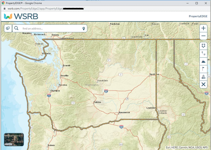
1. Log into WSRB.com and navigate to PropertyEDGE.
2. You'll see the search screen.
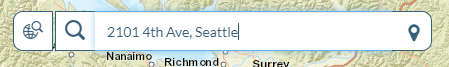
3. Enter an address in the search box.
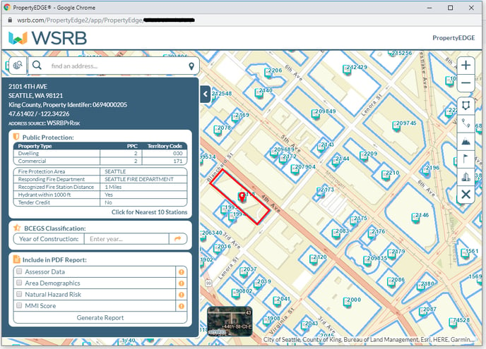
4. You'll see the results.
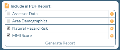
5. To get MMI, Lahar presence, Liquefaction susceptibility, Tsunami risk and Distance to fault, generate a building report. Select "Natural Hazard Risk" and "MMI Score," and click "Generate Report."
6. To get your report, be sure to disable any pop-up blockers.
7. Your report will download automatically. Open the report and scroll to page three to view the earthquake risk data.
We're always striving to improve. If this article didn't answer your question, please let us know.