Learn how to get data you can use to better understand wildfire risk in Washington state
In this article, you'll find answers to the following questions:
- What wildfire-related risk factor data is available on WSRB.com?
- What does the data mean?
- How do I find the wildfire risk data on WSRB.com using an address?
- How do I find the wildfire risk data using a latitude-longitude?
- How do I get other questions answered?
What wildfire-related risk factor data is available on WSRB.com?
For each location in Washington, you can find:
- Wildland-urban interface (WUI): The WUI is where built structures meet or mix with undeveloped natural areas. Properties in the WUI are at greater risk of wildfire damage than properties in highly developed areas with less vegetation to serve as fuel.
- Distance from historic wildfire perimeter: This data answers the question "Have past wildfires occurred within one mile? If so, when?" The data spans from 2000 to 2020, the latest year data is available for.
Back to Top
What does the data mean?
Distance from Historic Wildfire Perimeter
The WUI
You will see three types of results for WUI: Intermix Zone, Interface Zone and Not Present. Within Intermix Zone and Interface Zone, you will see more details. Here is more information about these categories, which are assigned at the Census Block level, and what they mean:
WUI Intermix Zone:
-
- There is at least one housing structure per 40 acres (16 hectares).
- Housing and vegetation intermingle.
- There is 50% continuous vegetation in the Census Block.
Within the WUI Intermix Zone, land can be classified into one of three categories, based on housing density per square kilometer.
-
-
- Low Density Intermix Zone
- Medium Density Intermix Zone
- High Density Intermix Zone
-
WUI Interface Zone:
-
- There is more than one house per 40 acres (16 hectares).
- Housing is in the vicinity of contiguous vegetation.
- Vegetation in the Census Block is less than 50%.
- The area is within 1.5 miles of an area that is greater than 1,325 acres (500 hectares) that is more than 75% vegetated. (This characteristic prevents small urban parks from being classified in the WUI.)
Within the WUI Interface Zone, land can be classified into one of three categories, based on housing density per square kilometer.
-
-
- Low Density Interface Zone
- Medium Density Interface Zone
- High Density Interface Zone
-
Not Present:
-
- The property you've looked up is not in the WUI.
Learn more about how growth in the WUI affects wildfire risk in our blog post.
Back to Top
Distance from Historic Wildfire Perimeter
If your results say "Yes," you will see the years past wildfires have occurred within one mile of the location.
If your results say "No," you will not see any years. This result means the property you've looked up is not within one mile of any historic wildfires since 2000.
Since 1950, a pattern of repeat fires in the Western U.S. has emerged. About 30% of previously burned land in the region has seen burn-on-burn effects, or fires in the same area where a fire had previously occurred. Repeat fires typically happen every seven years, about the amount of time necessary for an ecosystem to build up enough vegetation to burn again, according to the NASA Earth Observatory.
Learn more about repeat wildfires in our blog post.
Back to Top
How do I find the wildfire risk data on WSRB.com using an address?
- Login to WSRB.com.
- Access "Wildfire Risks" by hovering over the "Additional Risks" menu option at the top of your screen.

-
The search option box will default to "Address Search." Leave it as is and enter a street address and ZIP code.
-
Click "Search."
-
You'll see the results page. For this search, we used an address in Wenatchee.
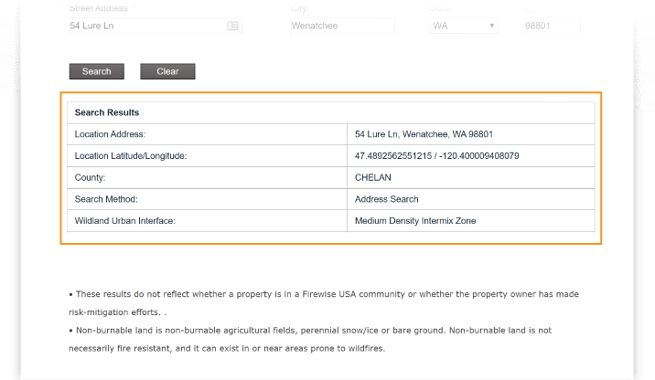
- You'll also see the explanations of each data point, as shown above. Scroll down for a map of the location.
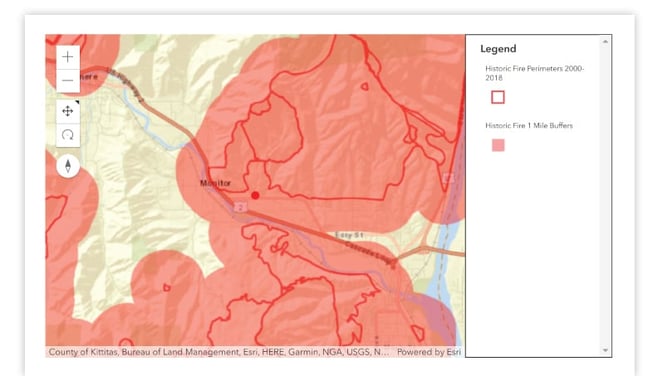
Areas outlined in red are historic wildfire perimeters.
Areas shaded red are one-mile buffers surrounding the historic wildfire perimeters.
- You can click on the "—" to zoom out or the "+" to zoom in.

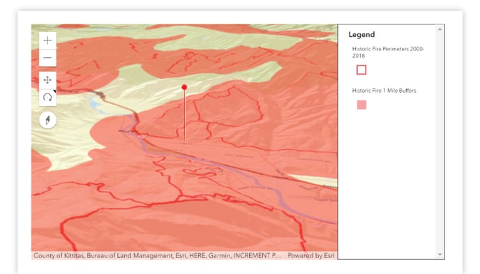
- You'll see a new version of the map. Here, we zoomed out.
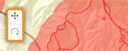
- You can also use the other map controls to rotate the map and view the location in three dimensions.
- You'll see a new version of the map.
Back to Top
How do I find the wildfire risk data using a latitude-longitude?
- Login to WSRB.com.
- Access "Wildfire Risks" by hovering over the "Additional Risks" menu option at the top of your screen.
-
The search option box will default to "Address Search." Click on search options box and select "Lat Long."

-
Enter a latitude and longitude.
-
Click "Search."
-
You'll see the results page. For this search, we used a latitude-longitude in Wenatchee.
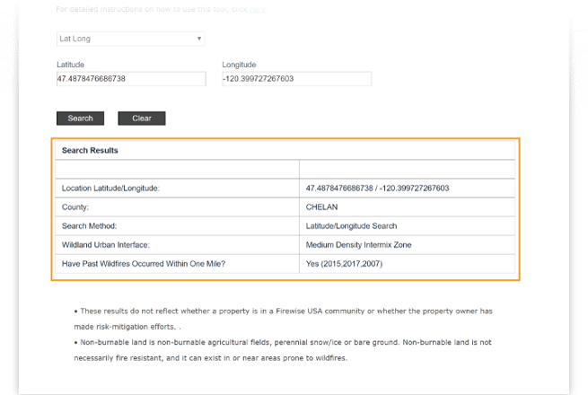
- You'll also see the explanations of each data point, as shown above. Scroll down for a map of the location.
Areas outlined in red are historic wildfire perimeters.
Areas shaded red are one-mile buffers surrounding the historic wildfire perimeters.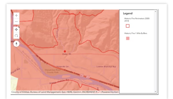
- You can click on the "—" to zoom out or the "+" to zoom in.
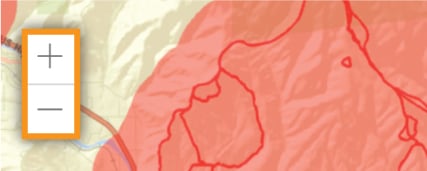
- You'll see a new version of the map. Here, we zoomed out.

- You can also use the other map controls to rotate the map and view the location in three dimensions.
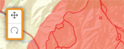
- You'll see a new version of the map.
Back to Top
How do I get other questions answered?
If you have other questions, contact our customer service team by clicking here or by calling 206-217-0101.
We're always striving to improve. If this article didn't answer your question, please let us know.