In this article, you'll find answers to the following questions:
- What earthquake-related risk factor data is available on WSRB.com, and what does it mean?
- How do I find the earthquake data on WSRB.com using an address?
- How do I find the earthquake data using a latitude-longitude?
What earthquake-related risk factor data is available on WSRB.com, and what does it mean?
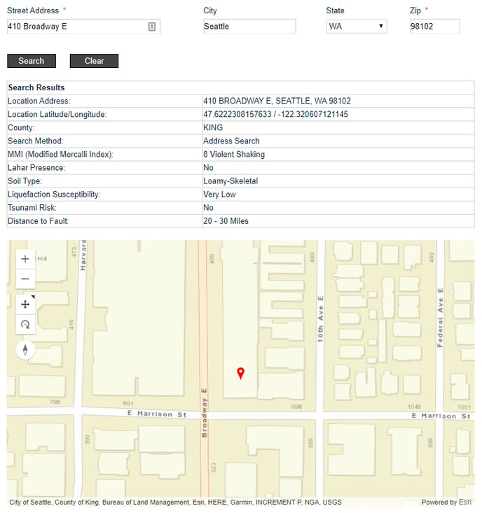
For each location in Washington, you can find:
- Modified Mercalli Intensity (MMI) Scale: A subjective measure of the intensity of shaking based on recorded earthquakes in the area. The MMI is specific to a location, and, unlike the Richter scale, the MMI measures the effects of an earthquake. Learn more about MMI in our blog post.
- Scores of 1 through 4 are considered imperceptible to moderate.
- Scores of 5 through 8 are strong to destructive.
- Scores of 9 through 12 are violent to cataclysmic.
- Lahar presence: Lahar is a type of mudflow. Earthquakes near a volcano can trigger a lahar avalanche and cause significant property damage. Learn more about lahar in our blog post.
- If Lahar presence is "Yes," there is a possibility of a lahar avalanche at the location due to an earthquake.
- If Lahar presence is "No," there is no possibility of a lahar avalanche at the location due to an earthquake.
- Liquefaction susceptibility: A measure of how likely soil is to liquefy during an earthquake. Structures built on soil prone to liquefaction will likely suffer more earthquake-related damage than structures built on less-susceptible soil. The determination of liquefaction susceptibility factors in soil type, depth of ground water and other physical characteristics of a soil deposit.Learn more about liquefaction in our blog post.
- Tsunami risk: A tsunami can occur after an earthquake. In Washington state, the Department of Natural Resources (DNR) has studied some parts of the coastline to study tsunami hazard. Learn more about tsunami risk in our blog post.
- If the Tsunami Risk is "Yes," the location is in the DNR's study area and is at risk of being affected by a tsunami.
- If the Tsunami Risk is "No," either:
- The location is in the DNR's study area and is not at risk of being affected by a tsunami OR
- The location is not in the DNR's study area.
- Distance to fault: The distance, in miles, to the nearest fault line.
Back to Top
How do I find the earthquake data on WSRB.com using an address?
2. You'll see the home page.
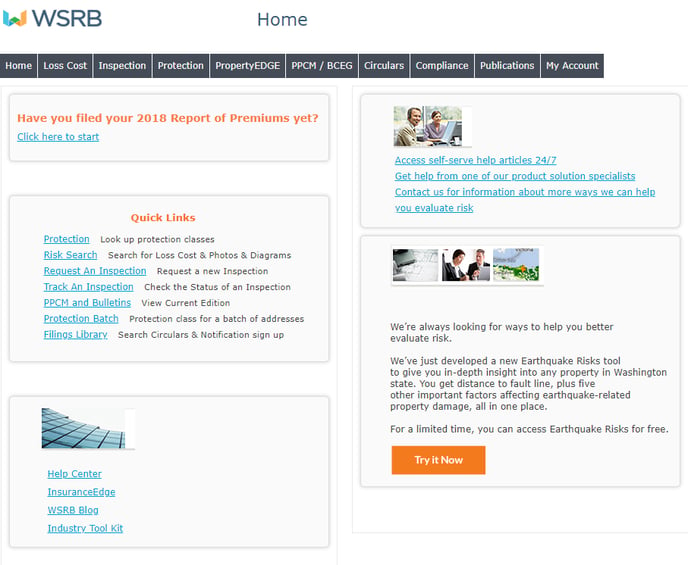
3. Click on "Try it Now."
4. You'll see the search page.
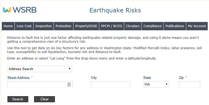
5. The search option box will default to "Address Search." Leave it as is and enter a street address and ZIP code.
6. Click "Search."
7. You'll see the results page.
Back to Top
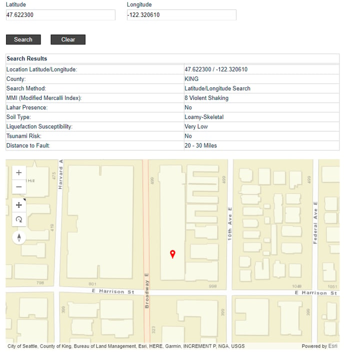
How do I find the earthquake data using a latitude-longitude?
2. You'll see the home page.
3. Click on "Try it Now."
4. You'll see the search page.
4. Click on the search options box and select "Lat Long."
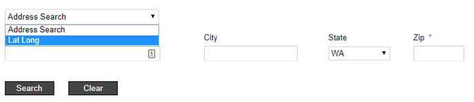
5. Enter a latitude and longitude.
6. Click "Search."
7. You'll see the results page.
We're always striving to improve. If this article didn't answer your question, please let us know.