How do I find a protection class by public land survey data (section-township-range) on WSRB.com?
Learn to use the Public Land Survey search option on Protection and how to get accurate results.
In this article, you'll find answers to these questions:
- What do I do if I have only the public land survey data (section-township-range) and not a specific address, parcel number or latitude/longitude?
- How do I look up a protection class by public land survey data (section-township-range)?
What do I do if I have only the public land survey data (section-township-range) and not a specific address, parcel number or latitude/longitude?
The public land survey (section-township-range) data consists of all the addresses within a square mile (or section). There can be many addresses within a square mile, so the protection class (PC) may vary within a section. If you have only the section-township-range, contact our Customer Service team at 206-217-0101 or by clicking here. Our Customer Service team will do additional research on the location you're evaluating to get you the information you need.
Please note WSRB can only provide PC data for addresses in Washington state. If you are looking for data for an address in another state, please click here for more information.
Back to Top
How do I look up a protection class by public land survey data (section-township-range)?
1. Log in to WSRB.com with your username and password.
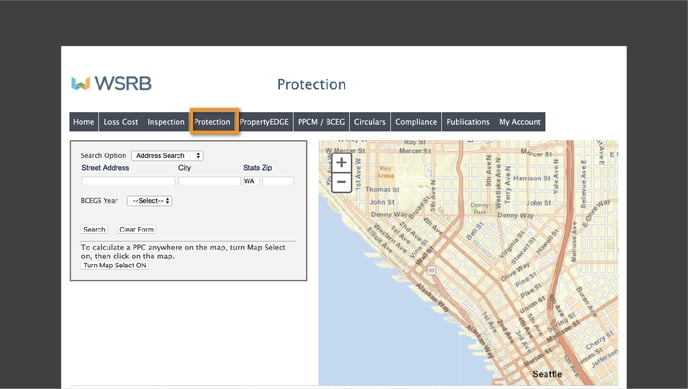
2. From the menu at the top of your screen, select Protection.
3. You'll see the search screen.

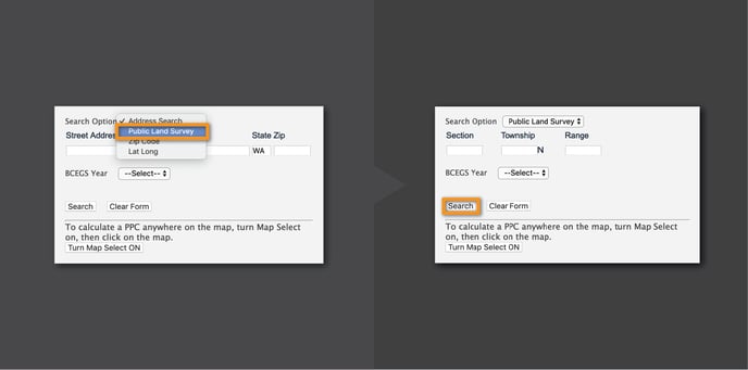
4. The "Search Option" box will default to "Address Search," so click in the box and select "Public Land Survey." You will see the "Section," "Township" and "Range" boxes.

5. Enter numbers in the "Section" and "Township" boxes. In the "Range" box, you must enter the range number followed by either a W (for west of Puget Sound) or an E (for east of Puget Sound), using either uppercase or lowercase letters.
6. Unless you are specifically looking for BCEGS® (Building Code Effectiveness Grading Schedule) data, you may leave that search box as "Select."
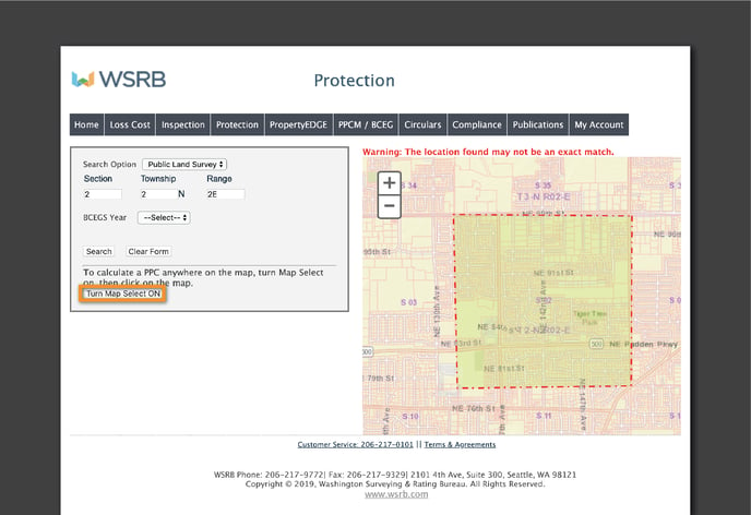
7. Click "Search," and the map will display the section-township-range you selected.

8. To get PC data, click "Turn Map Select ON" and click a location within the map.
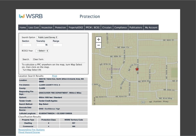
9. You'll see search results for a specific address, including the PC. Remember that the PC may vary within a section, especially in rural areas, so be sure to search until you find the data for the address you need.

10. To find the PC for another address in the same section-township-range, click on "Turn Map Select ON" again and click on another place on the map.
Remember, the protection class may vary within a section, so contact our Customer Service team if you need assistance. Call 206-217-0101 or click here.
We're always striving to improve. If this article didn't answer your question, please let us know.